GPX Explore
Draw it. Fix it. See the whole ride.
Every watch, bike computer and fitness service can hand you a GPX file. Most apps show you a line on a map. GPX Explore shows you the ride: where it climbed and how hard, what your heart rate and power were doing on that climb, how long you were actually moving, and how each kilometre went. And since version 2.0 it is also an editor: draw a new route that follows the trail, cut the drive to the trailhead off a recording, drag a stray point back onto the path, and save plain GPX that every device reads.
Mac, iPad, iPhone
Free to view. No account. Drawing and editing are GPX Explore Pro, one purchase in the app for your Mac, iPhone and iPad.
See it in action
Recorded in the app. Interface shown in English.
Draw a route
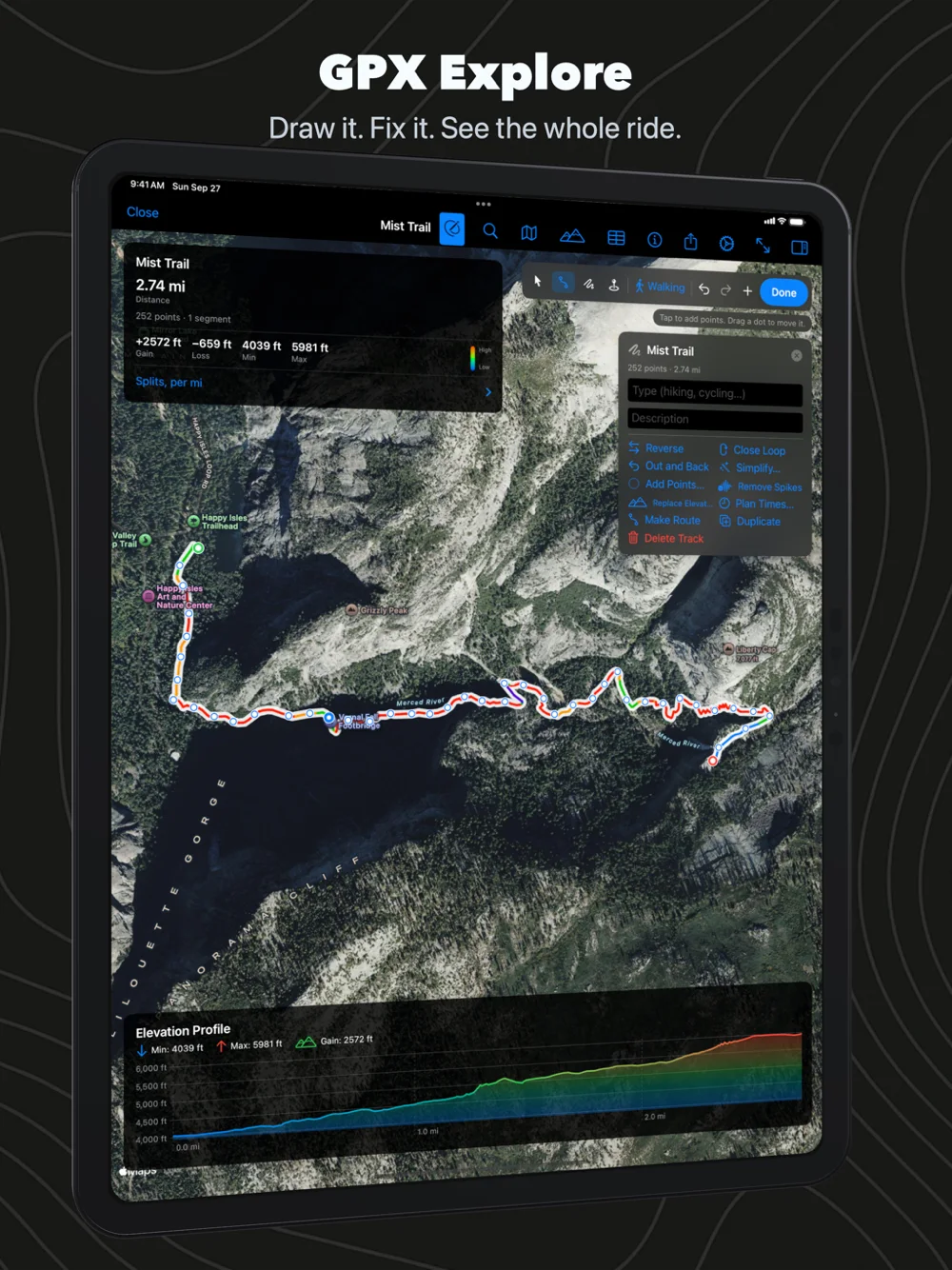
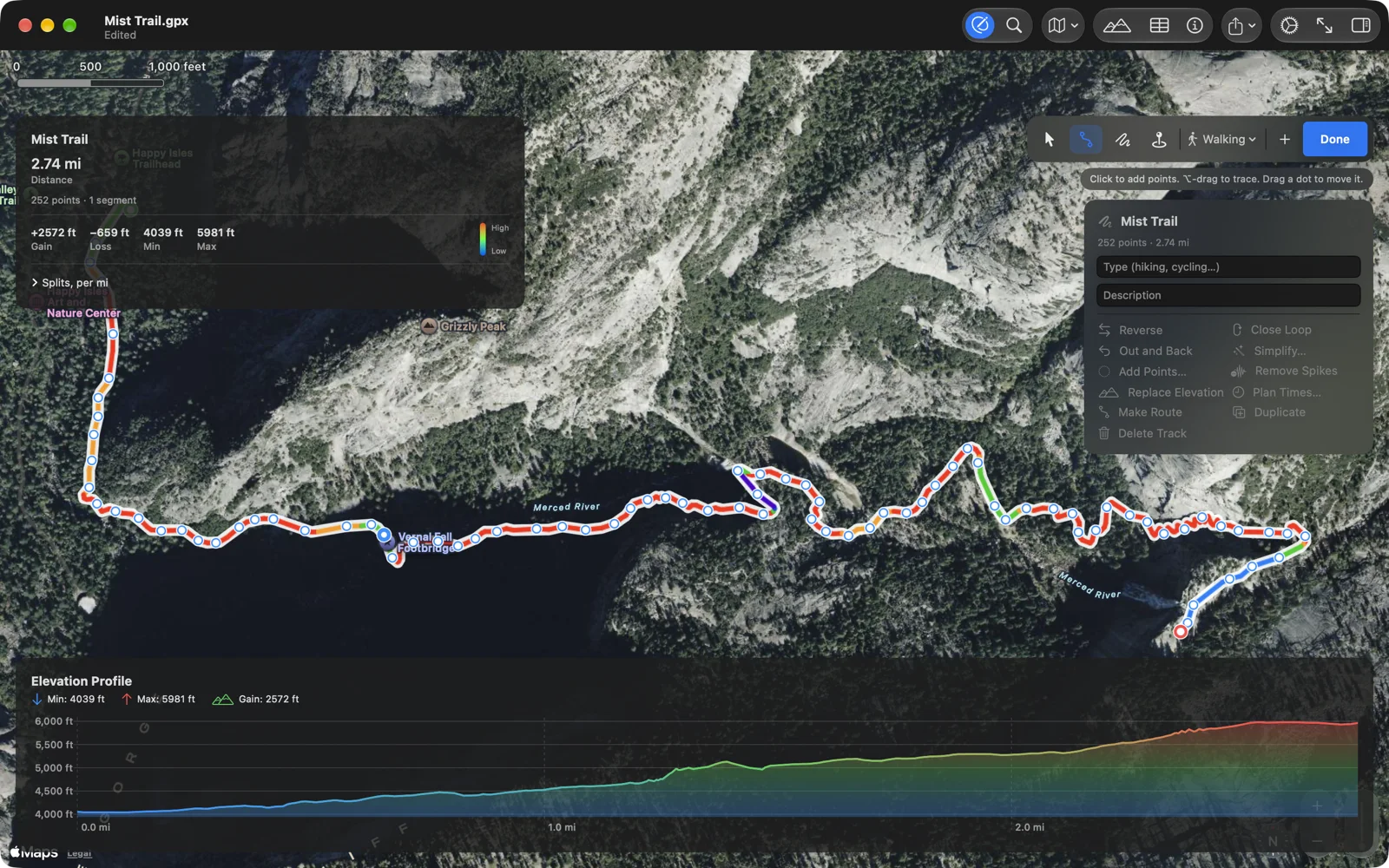
Click on the map where the route starts, then where it goes. Draw straight lines, or let Apple Maps follow the paths and roads for walking, cycling or driving, and each click lands on the path the way it does in a route planner. Drag any point you clicked and the route finds its way again. Trace freehand with the mouse, a finger or Apple Pencil when there is no path to follow. Close the loop back to the start, or turn the route into an out-and-back, with one click.
Elevation for every new point comes from a 30 m terrain model on our own server, the one Geo Elevation profiles with, so the climb is on the chart before you leave: above, three clicks up Yosemite’s Mist Trail give 2.7 miles and 2,500 feet of climbing. Give the route times at your walking or riding pace, slower uphill and faster down, and it plays in any app that wants a timed track, Xcode’s location simulator included.
Fix a recording
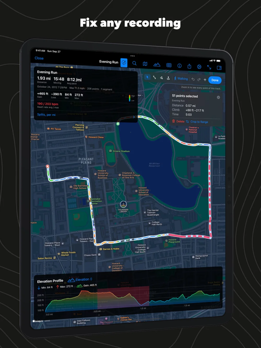
Everything a GPS gets wrong, you can put right. Cut off the drive to the trailhead. Delete the spike where the watch lost the sky and put you across the lake. Drag a point back onto the path, or click the small plus between two points to add one. Select a stretch between two points on the map, or on the Mac by dragging across the chart, and delete it, crop the track to it or split the track there. Join two days into one, reverse a route, simplify ten thousand points to the few hundred a bike computer accepts, add points to long straight legs, replace noisy altitude with the terrain model, shift the times of a watch that had the wrong clock. Every change can be undone, one step at a time.
Your file, kept whole
An editor that loses what you did not touch is not worth using. GPX Explore reads the complete GPX 1.1 schema and writes it back: metadata and links, waypoints with their symbols, routes, segments, fix quality, heart rate and power, and each app’s own extensions down to Garmin’s track colours, with their namespaces. A file you open and save without editing is written back byte for byte. We checked every sample file we have by reading it, writing it and reading it again, and by validating what it writes against the official GPX schema.
Try it, right here
This is a real file, a run around Washington’s McMillan Reservoir from a Garmin watch, drawn the way the app draws it. Move across the chart and the marker follows on the map; switch the series to heart rate or speed. In the app you do this with a finger on iPhone and a trackpad or mouse on the Mac, and the marker moves on the live map.

Move across the chart. In the app the same scrub works with a finger, a mouse or a trackpad.
Colour tells you the climb
The track is painted by grade: green on the flat and the gentle climbs, orange and red on the steep pitches, blue to purple on the way down. You can read a route before you ride it, and you can see where the hard part of the day was without touching the chart. A second mode colours by elevation instead, which is the better view of a mountain traverse, and both work on standard, satellite and hybrid maps.

Every number your watch recorded
GPX files from Garmin, Strava, Wahoo, Coros, Suunto and Apple Watch carry more than positions: heart rate, cadence, power, speed and temperature ride along on every point. GPX Explore charts any of them under the map, with a picker to switch series, and the route card sums up the workout the way a training log would: distance, moving time with the stops taken out, average pace for runs and hikes or average speed for rides, max speed, elevation gain and loss with GPS noise filtered, the sensor averages, and splits per kilometre or mile.

Those numbers were tuned on real files rather than tidy ones: a 2001 receiver that logged a point a minute, a watch that logs one a second, a planned route whose points carry edit stamps instead of a clock, a tour stitched into one segment across two years. Each of those breaks a naive formula, and the ones that shipped are the ones that survived all of them.
Files from anywhere
GPX Explore reads the complete GPX 1.1 schema and the GPX 1.0 files older tools still write: tracks, routes and waypoints with their names, symbols and comments, the file’s own metadata, and the extensions every exporter adds. Files that confuse other viewers open here: timestamps with fractional seconds, tracks with no elevation or no times, a route with no track at all, a file that is nothing but 9,000 waypoints. It has been fed exports from Garmin Connect, Strava, Komoot, RideWithGPS, GPSies, MapSource, GPS Visualizer, ExpertGPS, Geo Tracker and our own WorkoutGPX, which turns any Apple Health workout into a GPX file for it.
Made for the Mac
Eight in ten people who use GPX Explore use it on a Mac, and it behaves like a Mac app should. Double-click a .gpx file and it opens; ⌘N starts a new one on a blank map. Right-click the map for waypoints and splits, ⌥-drag to trace, and the Track menu has every tool with the undo and redo you expect. Press space in Finder and Quick Look draws the track, coloured by grade, before you open anything. The tracks and waypoints drawer shows every track, segment and waypoint in the file so you can hide the ones you are not looking at. Keyboard shortcuts cover the things you do all day: ⌘0 fits the track, ⌘E toggles the chart, ⌘I the route card, ⌘1 to ⌘3 switch map styles, ⌥⌘E starts editing.
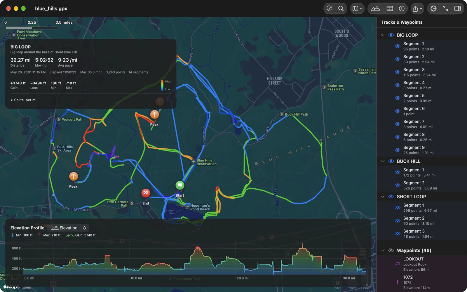
When you want the ride out of the app, share the GPX file from the toolbar, or export the map with the chart under it as a single picture, coloured as on screen, with the name and the numbers along the bottom.

On iPhone and iPad
The same app, the same file, the same editor made for a finger: tap to add points, drag to move them, long-press for more. Open a GPX from Mail, Messages, Files or any app that shares one: GPX Explore edits its own copy, and the original stays as it was. It lands on the map with the strip of numbers at the top; tap the strip for the full card and the splits. The chart scrubs with a finger. On iPad the drawer and the editing panel sit beside the map like they do on the Mac.
No file handy? Try these
Real tracks, free to use. Download one, then open it with GPX Explore.
- Blue Hills Reservation: three hikes, fourteen segments and forty-six named waypoints from a 2001 handheld, near Boston.
- McMillan Reservoir run: a 3 km run in Washington, DC from a Garmin watch, with heart rate.
- Brittany coast: a 25 km ride from Lannion to Plestin in two tracks.
- Mystic River trails: tracks, planned routes and waypoints in one file.
Yours stays yours
No account, no sync, no ads, no tracking. Your files stay on your device, and opening and viewing one sends nothing anywhere beyond the map tiles Apple Maps draws. When you draw or move points, GPX Explore sends just their coordinates to our own elevation server to look up the height, and when you choose to follow paths or roads it asks Apple Maps for directions. The elevation lookup can be turned off.
Questions people ask
How do I open a GPX file on a Mac? Install GPX Explore from the Mac App Store and double-click the file. If another app has claimed .gpx files, right-click the file, choose Get Info, pick GPX Explore under Open With and click Change All.
Does it show heart rate, power and cadence? Yes, when the file carries them. Garmin, Strava, Wahoo, Coros and Suunto exports and WorkoutGPX files from Apple Health all do. The chart’s picker lists whatever the file has.
Which files does it open? Any GPX 1.1 or 1.0 file: tracks, routes and waypoints, with or without elevation and timestamps, in any combination.
Can it edit GPX files? Yes, with GPX Explore Pro (since version 2.0), on the Mac, iPhone and iPad: draw new tracks and routes, move, add and delete points, delete or crop a stretch, split, join, reverse, simplify, fix elevation and times, and edit waypoints. Every change can be undone.
Can it plan a route that follows trails and roads? Yes. Choose walking, cycling or driving and the line between two clicks comes from Apple Maps directions; drag a point you clicked and the route is worked out again. Where Apple Maps has no path, it draws a straight line and says so.
Where does the elevation of a drawn route come from? From a 30 m terrain model (Mapzen’s, worldwide) served by our own elevation server. Recorded tracks keep the elevation your device measured unless you choose Replace Elevation.
Can it convert other formats? It reads and writes GPX. For turning Apple Health workouts into GPX, use WorkoutGPX.
Is it free? Viewing any GPX file is free on every platform, as it always was. Drawing and editing are GPX Explore Pro, a one-time purchase in the app that covers your Mac, iPhone and iPad; it also pays for the elevation server behind every drawn point.
What changed lately? Version 2.0 made it an editor: the release post tells the story.